Potential Tropical Cyclone Eighteen Gains Momentum in the Western Caribbean
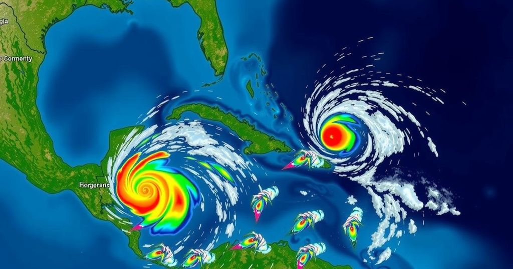
The National Hurricane Center has designated an area of low pressure in the western Caribbean as Potential Tropical Cyclone Eighteen (PTC18), which may strengthen into a tropical storm by late Sunday or early Monday and could reach hurricane status by midweek. A hurricane watch is in effect for the Cayman Islands and a tropical storm warning for Jamaica, as heavy rains are anticipated across the region. Meanwhile, another system, Subtropical Storm Patty, is affecting the Azores. November can yield late-season storms, underscoring the ongoing need for awareness and preparedness.
The National Hurricane Center (NHC) has classified a broad area of low pressure in the western Caribbean as Potential Tropical Cyclone Eighteen (PTC18). Predicted to strengthen into a tropical storm by late Sunday or early Monday, PTC18 may continue to gain power through midweek, potentially reaching hurricane strength as it approaches the Gulf of Mexico. As a precaution, a hurricane watch has been issued for the Cayman Islands, indicating possible hurricane conditions within 48 hours. Concurrently, a tropical storm warning is in effect for Jamaica, foreseeing tropical storm conditions within the next 24 to 36 hours. The projected path for PTC18 suggests a slow northwest drift, potentially causing heavy rainfall across the western Caribbean. There is, however, uncertainty regarding its impact on the U.S. Gulf Coast due to factors such as wind shear, diminishing moisture, and cooler Gulf waters, which may hinder its organizational structure and intensity. Additionally, the NHC is monitoring a low-pressure system near Puerto Rico and Hispaniola, which may bring localized flooding. This system’s potential for tropical development is low before merging with PTC18. Furthermore, Subtropical Storm Patty, which formed over the Northern Atlantic, is expected to produce gusty conditions in the Azores and the Iberian Peninsula early in the week. The western Caribbean is known for late-season storm formations, although the overall probability decreases as hurricane season comes to a close. Historical data indicates that November can produce storms every one to two years, with recent years showing varied storm activity in this month. For instance, 2022 experienced hurricanes Martin and Nicole, while the previous year saw no storm formations during November. These dynamics suggest that while activity may dwindle, the potential for late-season storms persists.
The Atlantic hurricane season typically peaks from August to October, with the final month, November, historically being less active for tropical development. However, specific oceanic and atmospheric conditions in regions such as the western Caribbean may still foster storm formation. Understanding the historical patterns of hurricane activity can help forecast potential threats during this period, particularly for areas vulnerable to hurricanes. The designation of Potential Tropical Cyclones by the NHC is significant as it allows for early warnings and preparedness initiatives even before the systems develop fully into tropical storms or hurricanes. Increments in atmospheric temperature and humidity can foster storms, especially near the Gulf of Mexico, where warmer waters often fuel cyclone strength. Moreover, monitoring conditions such as wind shear and dry air is crucial as these can inhibit storm organization and persistence, impacting potential landfall and safety preparedness for residents in the affected areas.
In summary, the National Hurricane Center has identified Potential Tropical Cyclone Eighteen, which is expected to strengthen and move through the western Caribbean, potentially impacting the Gulf of Mexico. The issuance of tropical storm warnings and a hurricane watch serves as a reminder of the need for vigilance during hurricane season. Despite November generally being less active, the potential for significant storm development remains, influencing both local weather patterns and broader regional safety protocols. As meteorologists continue to monitor this situation, residents in the trajectory’s path are encouraged to stay informed and prepared.
Original Source: weather.com


Post Comment